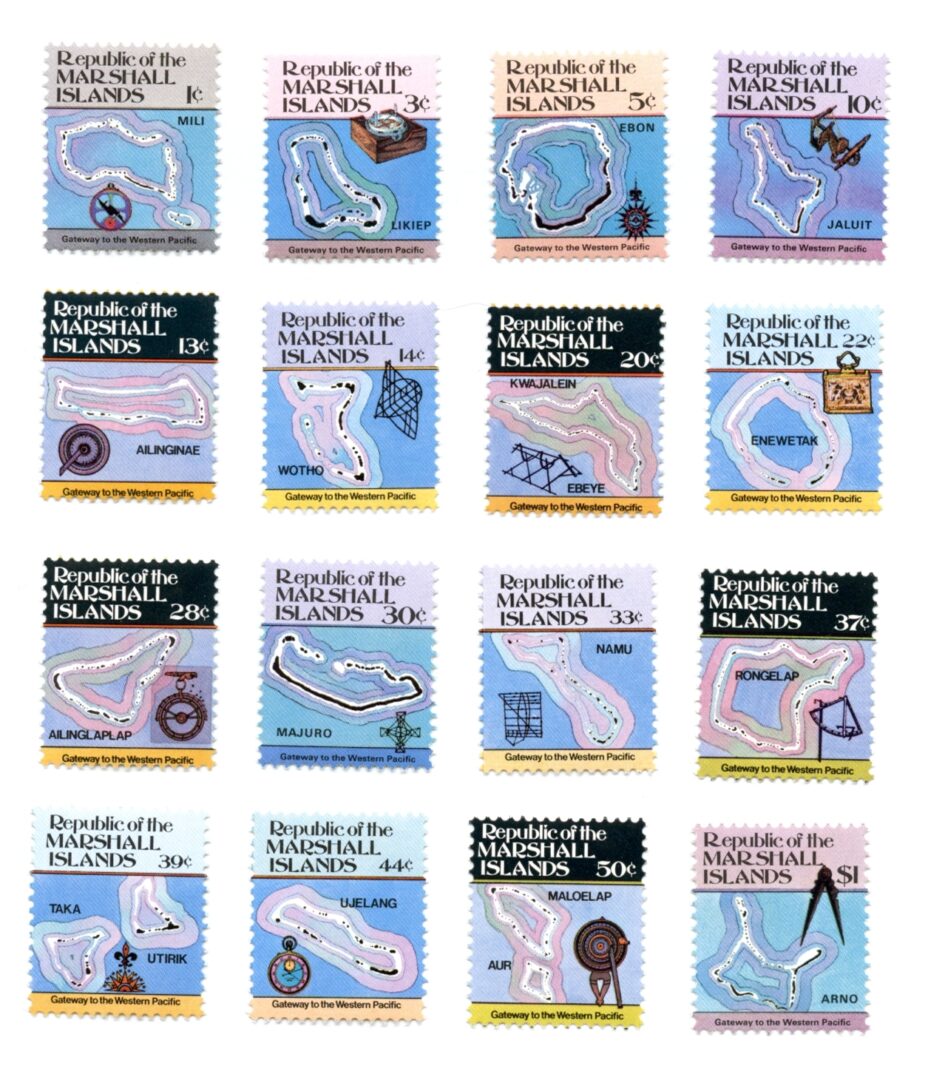
Marshall Islands-Maps/Navigational Instru.-Set (16)-Scott#35-49A
$11.58
Marshall Islands 1984/1985 – Maps and Navigational Instruments
Set of 16 – MINT
Marshall Islands-Scott #35-49A
Description
Marshall Islands 1984/1985 – Maps and Navigational Instruments – MINT
Set of 16
(#35: 1c value): Mili Atoll, Astrolabe (#36: 3c value): Likiep, Azimuth compass (#37: 5c value): Ebon, 16th cent. compass (#38: 10c value): Jaluit, anchor buoys (#39: 13c value): Ailinginae, Nocturnal (#40: 14c value): Wotho Atoll, navigational stick chart (#41: 20c value): Kwajalein and Ebeye, stick chart (#42: 22c value): Eniwetok, 18th cent. lodestone storage case (#43: 28c value): Ailinglaplap, printed compass (#44: 30c value): Majuro, navigational stick-chart (#45: 33c value): Namu, stick chart (#46: 37c value): Rongelap, quadrant (#47: 39c value): Taka, map compass, 16th cent. sea chart (#48: 44c value): Ujelang, chronograph (#49: 50c value): Maloelap and Aur, nocturlabe (#49A: $1 value): Arno, 16th cent. sector compassMarshall Islands-Scott #35-49A

Reviews
There are no reviews yet.